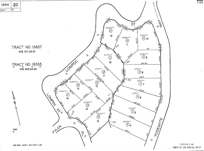
Parcel and Plat Maps
The map you see here depicts a page from the map book for the County of Los Angeles in California. The map books are very large, as many as 36 inches across. In California, the parcel number shows the book number and map number within the book along with the number for the particular parcel. The parcel shown here has the Assessor's Parcel Number (APN) 8673-037-004. This indicates that the map is found on page 37 of book number 8673 in the county recorder's records. Parcel numbers on these maps are circled, so you will find parcel 4 on New Hampshire Avenue where it begins to curve toward the west (note: the arrow indicates that north lies to the left on this map). Although it may be difficult to see here (remember, the original map is a couple of feet across), parcel dimensions are indicated along the sides of each lot.
This map shows the entire subdivision as the developer presented it to the county for development. Detail appears only on parcels that are part of this subdivision. Other adjacent subdivisions have a page number showing here (e.g., PG 30).